Pre-Design Survey Data Delivered with Speed and Accuracy
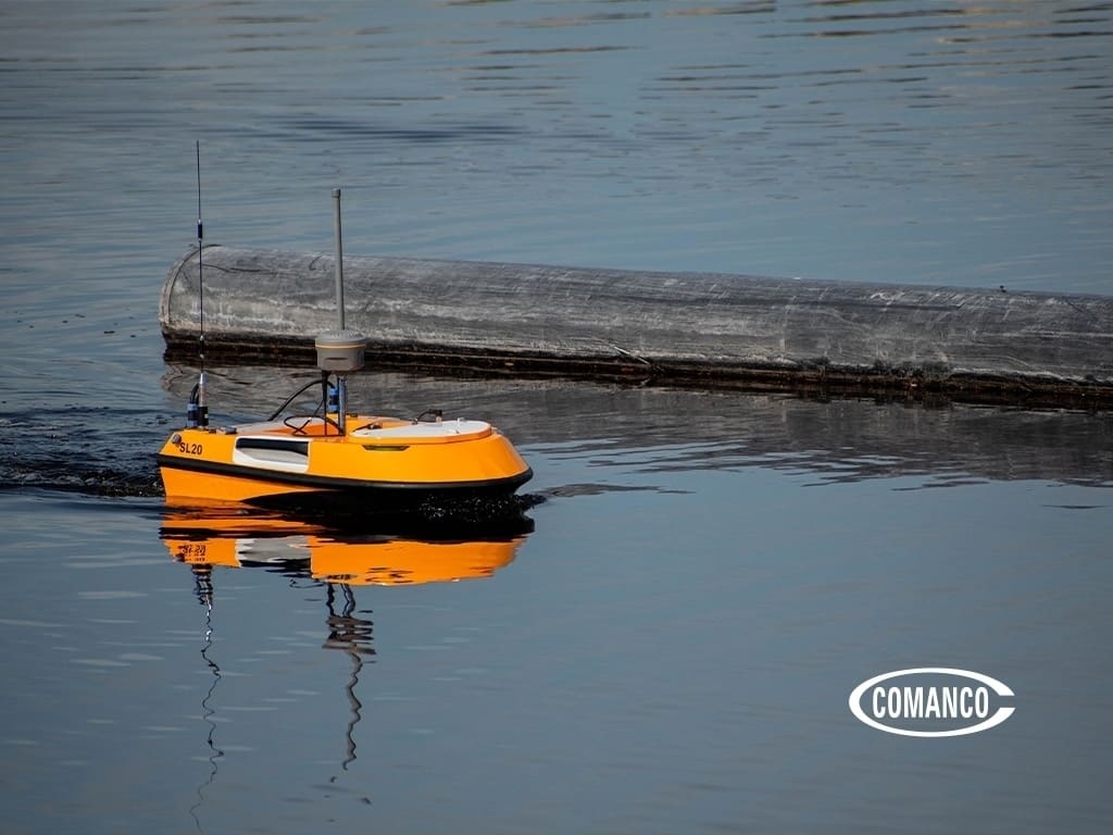
COMANCO recently provided critical pre-design survey data for a complex industrial system upgrade project where traditional hydrographic survey methods would have faced major operational challenges. Using advanced drone technology, autonomous survey vessels, and UAV systems, COMANCO successfully collected accurate hydrographic and topographic pre-design survey data safely and efficiently within an accelerated 24-hour turnaround.
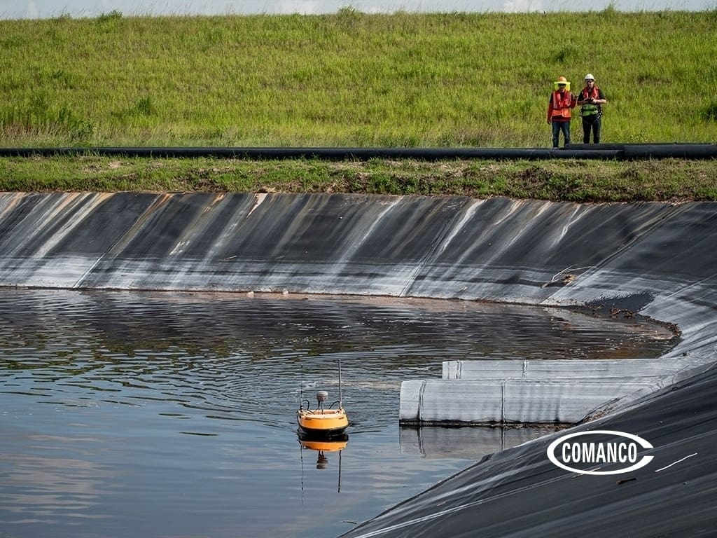
The project site presented several unique logistical obstacles, including tight operating areas, existing piping systems that needed to remain active and unmoved, hazardous process water, exposed geomembrane liner surfaces, and extremely shallow water depths measuring less than six inches in some areas.
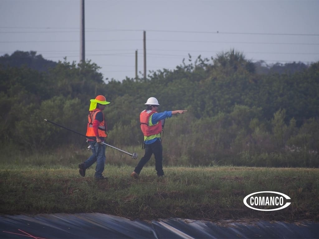
For many traditional survey methods, these conditions would create delays or prevent accurate data collection altogether. However, COMANCO’s specialized drone fleet and experienced survey team were able to complete the project safely while minimizing disruption to ongoing facility operations.
Advanced Drone Technology for Pre-Design Survey Data
COMANCO utilized a combination of unmanned aerial vehicles (UAVs) and autonomous hydrographic survey boats to gather highly accurate pre-design survey data for engineering and design purposes.
This technology allows engineers and project managers to receive:
- Accurate hydrographic mapping
- Updated topographic site data
- Faster project planning support
- Reduced operational disruptions
- Improved safety during hazardous site conditions
The use of drone-assisted surveying also improves efficiency in difficult-to-access environments where traditional manned vessels or ground crews may face safety concerns or physical limitations.
Supporting Engineering and System Upgrades
The pre-design survey data collected by COMANCO provided engineers with an accurate and up-to-date dataset needed to support future system upgrade designs. High-quality survey information plays a critical role during the engineering and planning phase of environmental and industrial construction projects.
Accurate data collection helps reduce redesigns, improve project scheduling, and minimize unforeseen site conditions during construction.
COMANCO’s ability to complete the full survey and data submission process within just 24 hours helped the client maintain project momentum and meet demanding scheduling requirements.
Innovative Environmental Construction Solutions
Projects like this demonstrate COMANCO’s commitment to delivering innovative environmental construction and technology-driven solutions for clients across the United States.
From hydrographic surveying and drone mapping to geosynthetic installation and environmental containment, COMANCO continues providing advanced solutions for mining, wastewater, industrial, and landfill applications.
Learn more about COMANCO’s environmental and construction services:
https://comanco.com/services/
For additional information about UAV and hydrographic surveying technologies, visit:
https://www.usgs.gov/
COMANCO is proud to provide safe, efficient, and accurate solutions for complex project environments.
SAFETY ★ QUALITY ★ SERVICE
COMANCO is an environmental, commercial, and civil construction company.
Contact COMANCO to learn how our team supports projects across the industry.
📍 4301 Sterling Commerce Dr, Plant City, FL 33566
📞 (813) 988-8829
🌐 www.comanco.com