When it comes to any construction service, safety is always paramount. When it comes to surveying services, specifically, data integrity is a close second.
In this day and age, innovative technologies like drones certainly allow us to leverage our surveying practices with safety and speed. However, accurate data is foundational. To say data is truly “accurate,” a multifaceted approach and an acute understanding of each phase are required.
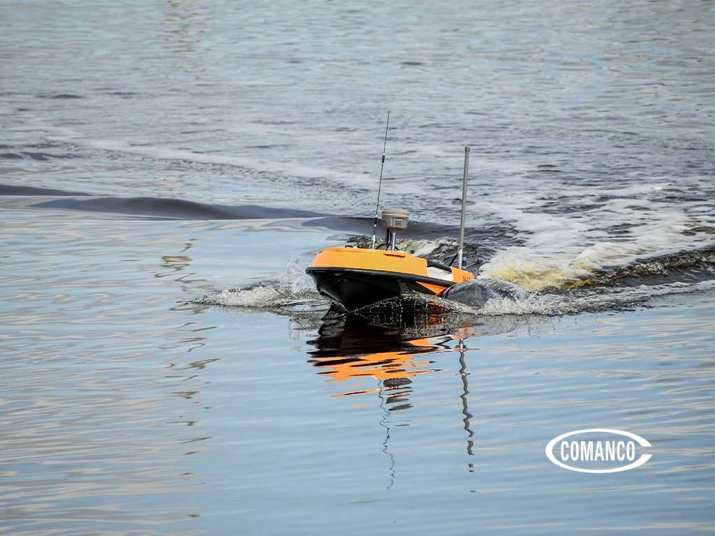
Good surveys start with quality collection devices run by competent operators agile enough to pivot when conditions aren’t ideal. Simply put, they get the job done right when faced with day to day variables congruous with construction sites.
Next, the utilization of consistent computer processing software is vital when it comes to downstream value. Here at COMANCO, we invest in proven processing platforms with features that notify us when there are inconsistencies, have post-processing quality reporting, and have comparative tools to prior data sets.
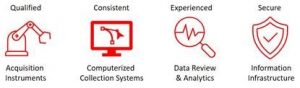
Simultaneously, the processing of data is only as good as the skilled individuals behind the mouse. To get the most value out of a survey, experienced, objective interpretation of results is critical. “Does this make sense?” is the first thing we ask ourselves. A lot of time and money goes into collection, and folks tend to be biased towards what they produce – “it is good enough.” It takes a professional to identify issues, understand the causes, adjust as needed, and do it again in a timely fashion.
Finally, something we take very seriously is the respect that these data sets are the customer’s property. Information needs to be stored and transmitted extremely tactfully.
So, whether you need hydrographic surveys for pond volume calculations, overflow awareness, fish migration, or pre-design purposes, data integrity is paramount because it is relied upon for a myriad of real world, high dollar applications.
Some food for thought when choosing a hydrographic surveyor that utilizes sonar methods to do work on your next project:
- Does your surveyor understand the acoustical properties of the water body? Water acoustics are a function of temperature and turbidity (like salinity). Knowing the speed of sound in the water body you are surveying is key to honing in your sonar device.
- Different survey areas require different acoustics. Higher frequency acoustics tend to be absorbed with less range (faster) than lower frequency acoustics. In other words, high precision in shallow depths requires a high-frequency echosounder. On the flip side, if you are dealing with extremely deep areas, and resolution isn’t as important as the ability to physically range to those depths, you may need to consider lower frequencies.
- Does the tide play a role? Tidal effects play a role in marine environments. When providing a data set, depths need to be relative to the time of day and associated tide movements.
- Understand that cleaning data is always necessary. No matter how good a surveyor is, there will always be some outlier ‘noise’ in your data. This takes an experienced technician to understand what is an outlier and what is bad data.
- Factor in other physical settings based on the particulars of the site. These include but are not limited to Ping Rate, Pulse formation, the speed of boat based on swath width, and more.
If your current service provider isn’t able to instill confidence that they are taking all of these factors into consideration, the data you are receiving is likely not as accurate as it can or should be.
If you’re looking for a hydrographic survey with the highest data integrity, contact COMANCO to receive a free quote of our services.
SAFETY ★ QUALITY ★ SERVICE